|
|
 |
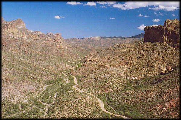
That's right! This is the Apache Trail (aka Arizona
State Route 88), as it winds east from its crossing of Fish Creek, on the
north side of the Superstition Mountains.
This photo is taken from the same road, before it descends to the right (out
of the picture) and then back to the left, in this image. Many people get white
knuckles and start breathing rapidly when going down this stretch of the
"highway".
One time we saw an "18 wheeler" (a big truck, for the non-Americans
in the audience) jack-knifed and stuck on the Fish Creek Bridge in this canyon. The
driver and the visiting Arizona Highway Patrol troopers were not happy. How he even
got that far is a mystery.
You surely do not want to try bringing any long vehicle on this road.
And yes, it is dirt and gravel for a good deal of the way. But definitely, it is one
of the most scenic roads in Arizona. Also, by the way, bring water with you, and a
good spare tire!
Next View >>
See the GeoHistory page if you want to know
more about why the landscape looks the way it does, or return
to the map of "The Superstition Mountains" for more view locations.
You can also send this as an E-Postcard
to your friends!
|
|
|
|
 |
 |
|
 |
|
|
