|
|
 |
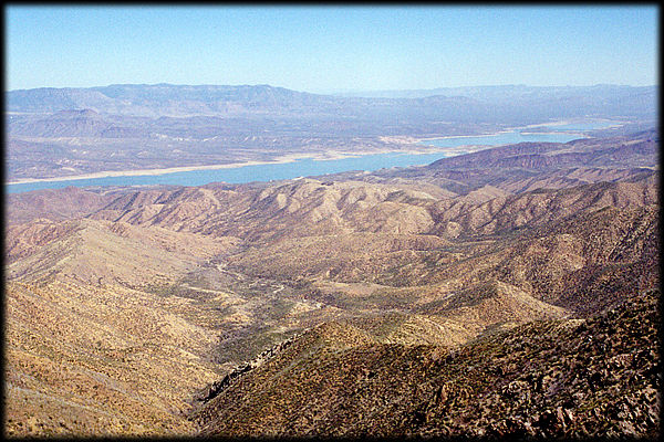
This view looks east from Four Peaks, across Roosevelt Lake,
towards the Sierra Ancha, which form the skyline in the left half of the picture.
Roosevelt Lake is the largest of the lakes along the Salt River (Rio Salado), and was
created in 1911 by the construction of Roosevelt Dam.
The big valley here is called the Tonto Basin (Tonto Creek flows into it from
the left), and it is one of the largest valleys in Arizona's Central
Highlands. The area is rich in archaeological sites, with the rugged Sierra Ancha
containing numerous ruins and cliff dwellings.
<< Previous View
See the GeoHistory page if you want to
know more about why the landscape looks the way it does, or return to the map of "The Superstition Mountains"
for more view locations.
You can also send this as an E-Postcard
to your friends!
|
|
|
|
 |
 |
|
 |
|
|
